
Australia’s Red Centre Turns Green
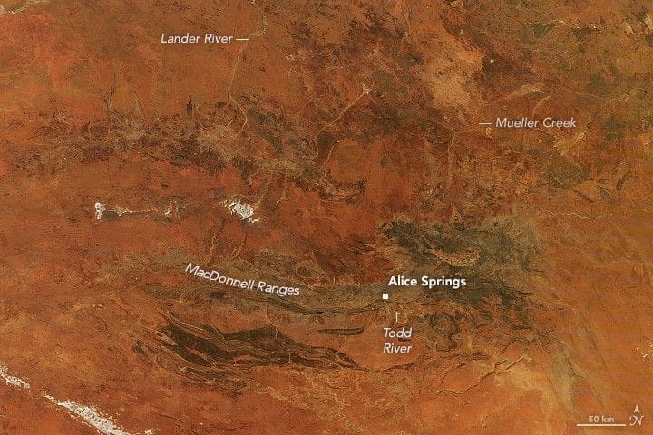
The town of Alice Springs sits near Australia’s geographic center in a region often called the Red Centre for the rusty hue of its desert. After weeks of heavy rainfall in February and March 2026, vast swathes of desert and surrounding mountains turned lush and green.
The MODIS instrument on the Terra satellite captured an image of the southern Northern Territory on March 10, 2026; a January image shows the area before the rains began. The landscape usually appears red because iron-rich rock has oxidized over time. When rain is sufficient, water flows through previously dry riverbeds and dormant plants spring to life.
February 2026 brought an area average of 239 millimeters (9 inches), marking the territory’s third-wettest February on a record that dates to 1900, the Bureau of Meteorology noted. The heavy rains also caused disruptions. Thunderstorms earlier in the month pushed water levels on the Todd River and other local rivers, and flash flooding in Alice Springs uprooted trees and left some people stranded.
Australia, Alice Springs, Northern Territory
alice springs, red centre, northern territory, terra satellite, modis, heavy rainfall, flash flooding, todd river, desert greening, bom