
Huíla plateau rises above Angola's southwestern coastal plains
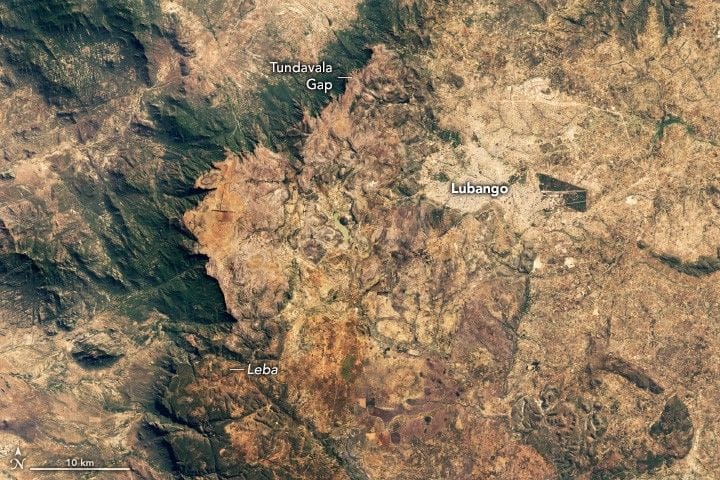
NASA Earth Observatory imagery shows the Huíla plateau rising to around 2,300 meters (7,500 feet) above the coastal plains of southwestern Angola, where a sharp cliff line marks a sudden shift from arid lowlands to more-temperate highlands. The featured mosaic was assembled from scenes acquired on June 19 and 20, 2025, by the OLI-2 and OLI instruments on Landsat 9 and Landsat 8, and a longer view came from the VIIRS instrument on the Suomi NPP satellite.
Areas near the plateau edges appear green with vegetation but become much browner by late September, the end of the dry season when almost no rain falls. The plateau is part of the Great Escarpment of southern Africa, a roughly 5,000-kilometer feature that runs from Angola through Namibia and South Africa and then into Zimbabwe and Mozambique.
The report also notes that Lubango, one of Angola's largest cities, occupies a valley on the Huíla plateau and is noted for its mix of cultures, striking architecture, and locally produced foods. Scientists believe the escarpment formed after the breakup of Gondwana in the Jurassic period and say erosion has since left the escarpment sitting 50 to 200 kilometers back from the coast.
Key Topics
Science, Huila Plateau, Angola, Great Escarpment, Lubango, Tundavala Gap