
Landsat 9 image shows Cedar Breaks amphitheater and its layered rocks
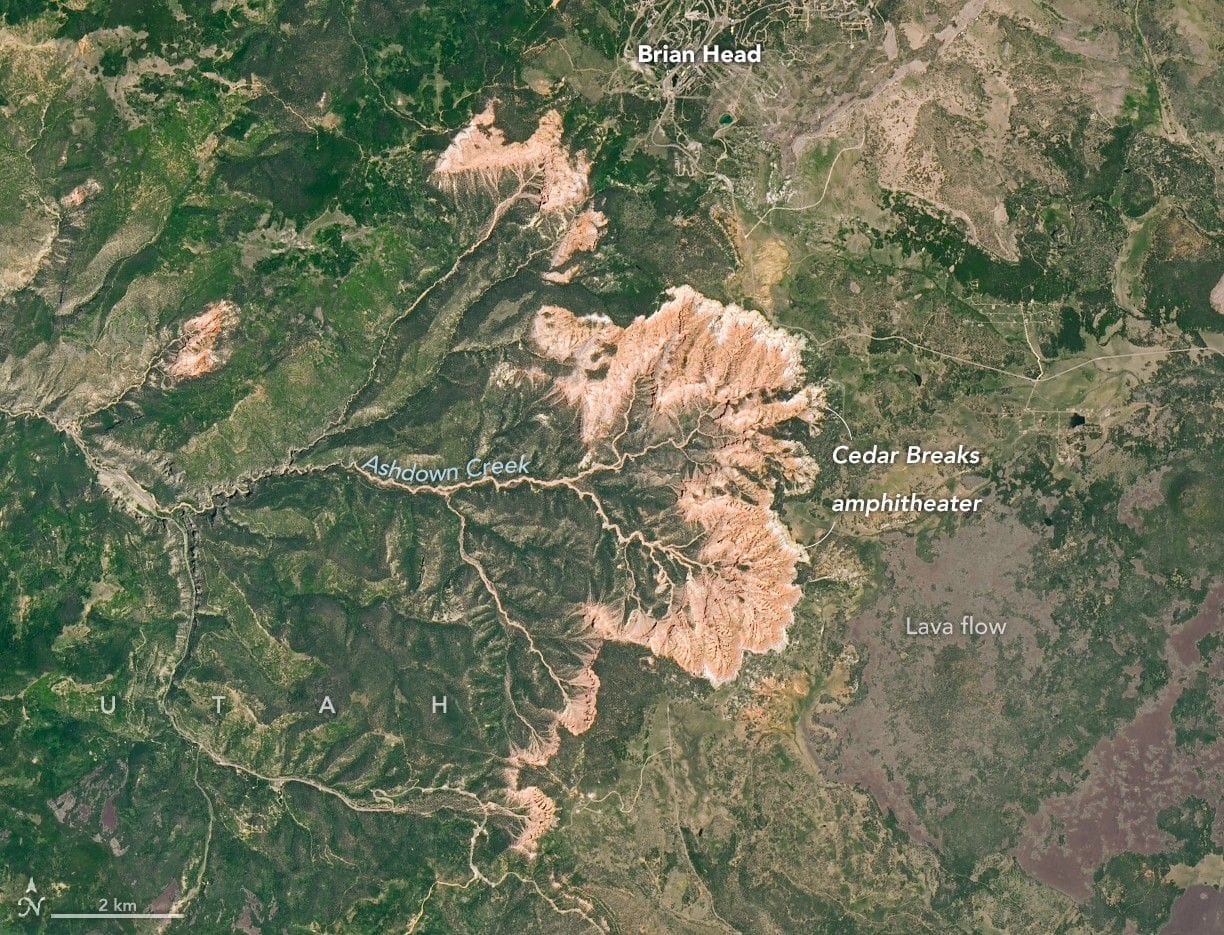
An image released as NASA Earth Observatory’s Image of the Day for January 5, 2026 shows the bowl-shaped escarpment of Cedar Breaks National Monument in southwestern Utah. The OLI-2 (Operational Land Imager-2) on Landsat 9 captured the amphitheater’s semicircular rim and deeply eroded drainages on June 18, 2025.
The photograph highlights channels, cliffs, and canyons carved by Ashdown Creek and its tributaries, along with physical and chemical weathering. The monument’s striking spires and pinnacles are made of sedimentary rock layers laid down roughly 50 to 25 million years ago in a basin that at times held Lake Claron; many limestone layers began as carbonate-rich muds on that ancient lakebed.
Layer colors reflect changing depositional conditions: wetter intervals left iron-poor or poorly oxidized sediments that became white or gray rock, while drier periods produced iron oxidation and red or orange layers. Tectonic uplift placed these layers atop the Grand Staircase; the rim at Cedar Breaks sits about 10,000 feet (3,000 meters) above sea level, roughly 7,000 feet above the Colorado River.
The image also shows volcanic features: dark basaltic lava flows east of the amphitheater formed between 5 million and 10,000 years ago on the Markagunt Plateau, and pyroclastic tuff surrounds the Brian Head summit. NASA Earth Observatory credited the image to Michala Garrison using Landsat data from the U.S.
Key Topics
Science, Lake Claron, Grand Staircase, Markagunt Plateau, Ashdown Creek