
Lava Flows Down Mayon Volcano
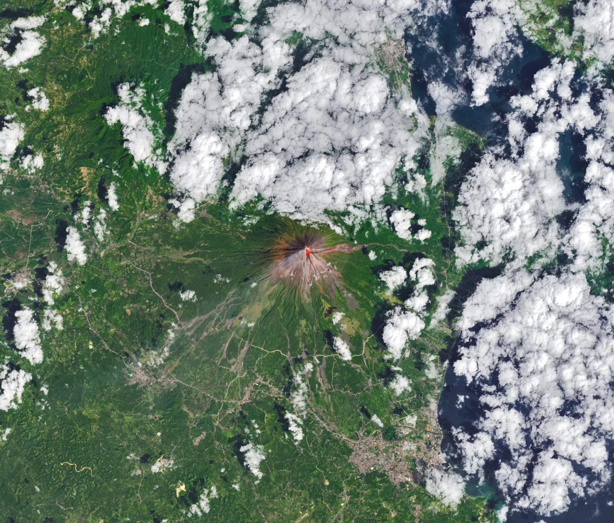
The OLI (Operational Land Imager) on Landsat 8 captured a rare, relatively clear image of Mayon, the Philippines' most active volcano, on Feb. 26, 2026. The natural-color view is overlaid with infrared observations to highlight the lava's heat signature.
On the same day the Philippine Institute of Volcanology and Seismology reported volcanic earthquakes, rockfalls and hot clouds of ash and debris known as pyroclastic flows.
Multiple NASA satellites also monitored the volcano's sulfur dioxide emissions, showing sizable plumes drifting southwest on Feb. 4 and March 6.
Philippines, Mayon
mayon volcano, philippines, landsat 8, oli, nasa satellites, lava flows, pyroclastic flows, volcanic earthquakes, rockfalls, sulfur dioxide