
NASA satellite data helps Maine oyster farmers pick sites and predict growth
Maine oyster farmers are using NASA satellite data to choose where to grow and to estimate how quickly oysters will reach market size. Oyster farmer Luke Saindon of The World Is Your Oyster in Wiscasset, Maine, used satellite maps and a site-selection tool created by University of Maine researchers to find a wide, shallow bay where his oysters have thrived.
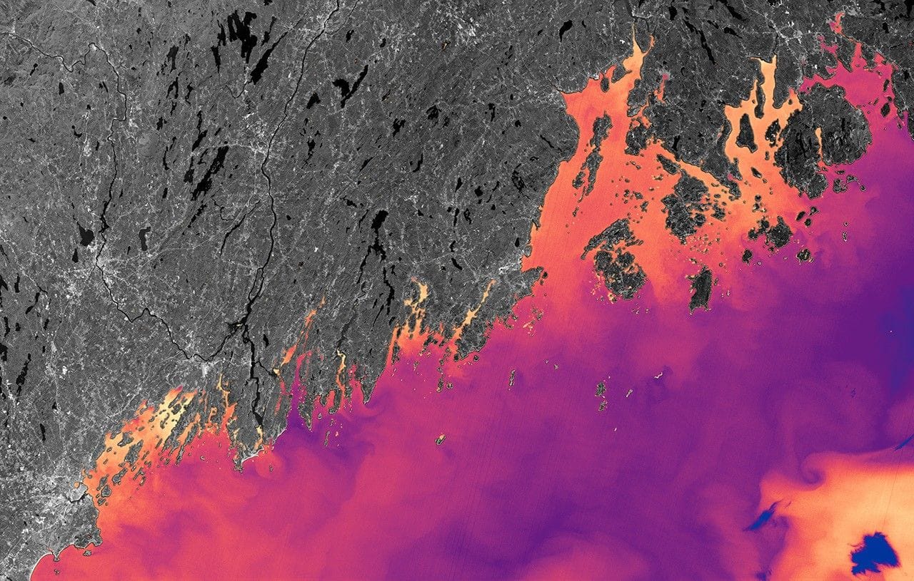
A University of Maine-led study published Jan. 15 in the journal Aquaculture shows how Landsat temperature data combined with Sentinel-2 estimates of chlorophyll and particulate organic matter can feed a model that predicts oyster growth by simulating how oysters allocate energy to growth, survival and reproduction.
Landsat’s 30–100 meter pixels reveal finer-scale coastal temperature patterns important to growth, and the team built 10-year seasonal climatologies to address cloud cover and infrequent overpasses. The model was validated against seven years of field data, and researchers say it can inform decisions such as when to seed and harvest; the Maine oyster industry grew in value by about 78% from 2011 to 2021, rising from about $2.5 million to more than $10 million.
The University of Maine team is developing an online tool that will let growers click a coastal location to receive a time-to-market estimate, and researchers also run workshops through Maine’s Aquaculture in Shared Waters program.
Key Topics
Science, Nasa, Maine, Landsat, Eastern Oyster