
Satellite Data Explorer (SDX)
The Satellite Data Explorer (SDX) from NASA’s Commercial Satellite Data Acquisition (CSDA) program is a web-based data discovery and access tool that enables approved users to search, discover, task, access, and download commercial Earth observation data the CSDA program has acquired from its commercial partners.
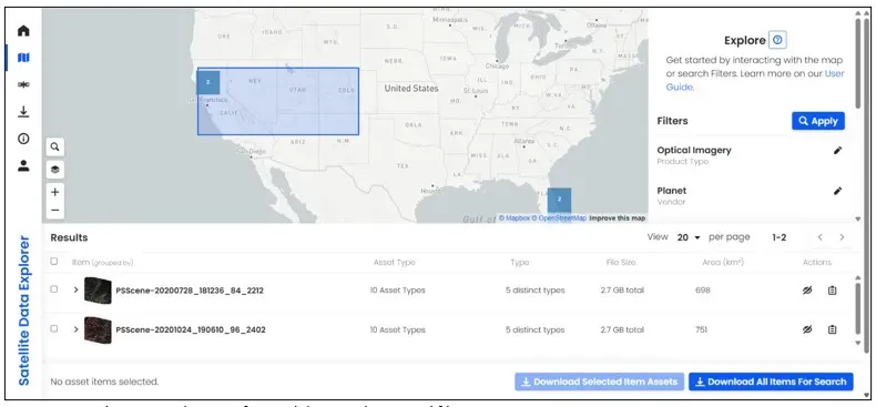
SDX provides quick-browse scene thumbnails for satellite imagery and point icons for GNSS science data, and it lets users filter searches by product type (imagery, DEMs, SAR, GNSS science data, etc.), date, and area of interest. The interface features a Navigation Panel for fast access to Welcome, Explore, Downloads, and the User Guide, plus spatial filtering (draw an AOI, upload a GeoJSON file, or enter latitude/longitude), temporal filtering, and metadata filters such as resolution, instrument mode, orbit direction, track number, instrument type, polarization, and quality flags like cloud cover.
United States
satellite data, sdx, nasa, csda, earth observation, gnss, imagery, dems, sar, geojson