
Satellite images show damage at Fuerte Tiuna after capture of Nicolás Maduro
New satellite imagery shows damage at Fuerte Tiuna, the military complex where U.S. forces captured the Venezuelan president, Nicolás Maduro, on Saturday.
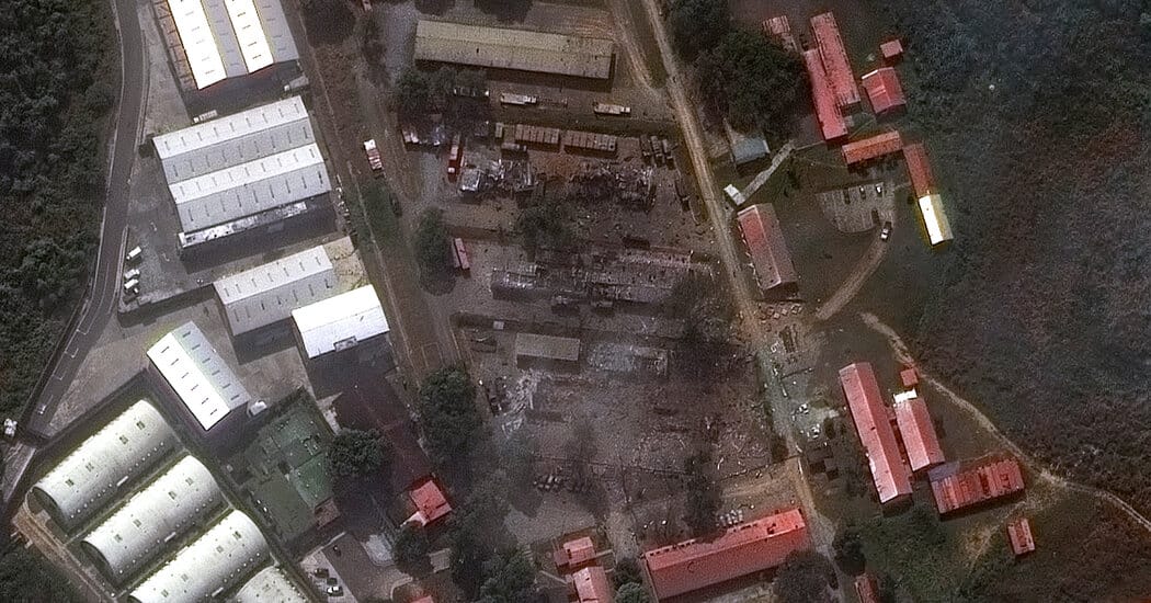
Before-and-after imagery released on Sunday by Vantor, a Colorado-based space technology company formerly known as Maxar Intelligence, shows that at least five buildings at the complex were destroyed by U.S. forces. Fuerte Tiuna, Venezuela’s largest military base, is built into a mountainside in the south of the capital, Caracas, and consists primarily of military installations with fortifications and roads winding around the compound. Satellite images dated Dec. 22 and Jan. 3 in the release show buildings, cargo containers and vehicles inside the base and later show multiple buildings destroyed.
A gate and a security building in a wooded area near the compound were also shown destroyed in the Jan. 3 imagery. Cargo containers, military trucks and trailers were visible near the damaged structures, although it is not clear what they contained. The imagery release did not provide further details.
Key Topics
World, Nicolás Maduro, Fuerte Tiuna, Caracas, United States Military, Vantor