
Satellite maps show rising wildfire activity across the far north
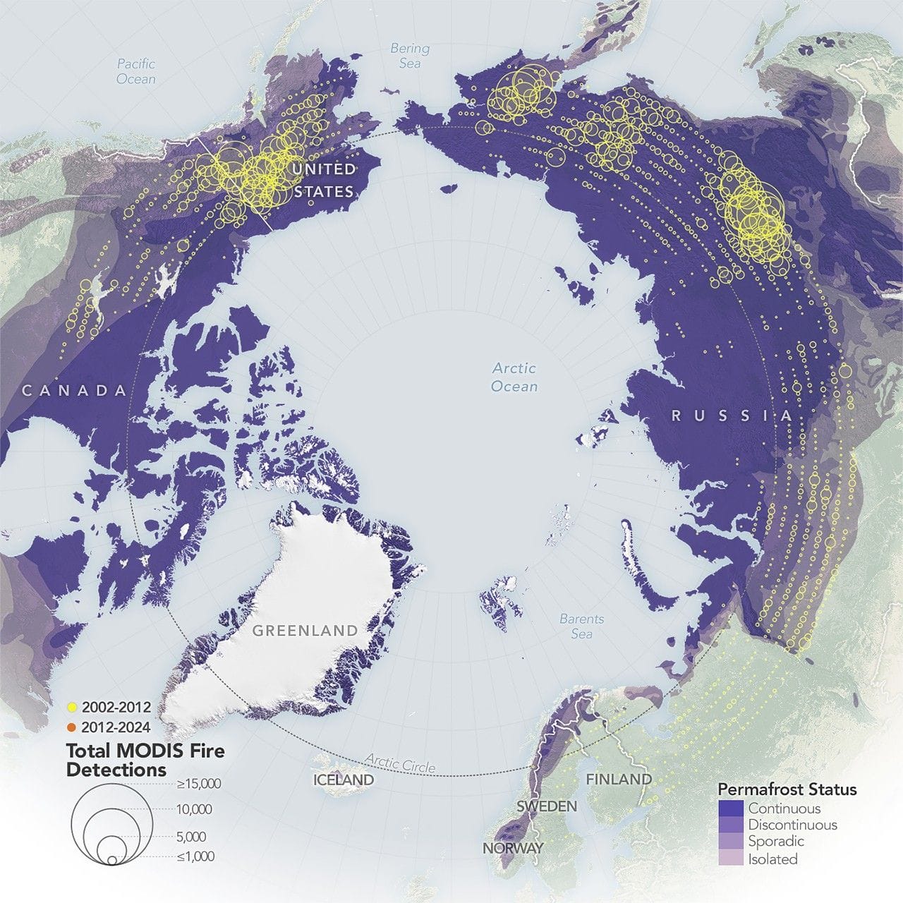
Satellite-based maps from NASA show wildland fires in the far north have become more frequent and widespread, with the largest increases occurring in northern Eurasia. The maps use fire detections from the MODIS sensors on NASA’s Aqua and Terra satellites and compare detections from 2002–2012 (yellow) with 2012–2024 (orange).
Circles on the maps indicate detection counts, with the largest circles representing areas with 15,000 or more detected fires; the underlying fire detection data come from NASA’s Fire Information for Resource Management System (FIRMS). Although fires north of 60 degrees latitude occurred across both North America and Eurasia in the 2000s, their numbers rose sharply beginning in the early 2010s, most dramatically in Eurasia.
Even Greenland experienced more large fires during this period, though still too few to be visible on these maps. Researchers attribute the trend to rising temperatures that make northern landscapes more flammable and to a poleward expansion of lightning, the primary ignition source, according to a 2025 report by the Arctic Monitoring and Assessment Programme (AMAP).
NASA researchers also say fires in the region are burning larger, hotter, and longer than in previous decades; as Jessica McCarty, deputy Earth Science Division chief at NASA’s Ames Research Center and lead author of the report, said, “Fire has always been a part of the boreal and the Arctic landscape.
Key Topics
Science, Arctic Wildfires, Northern Eurasia, Greenland, Modis, Firms