
Searching for selenite at Oklahoma’s Salt Plains
Salt-crusted plains in present-day Oklahoma once supplied native tribes and homesteaders with an inland source of salt for food, tanning hides, and trade. The site, about 90 miles (150 kilometers) northwest of Oklahoma City, became Salt Plains National Wildlife Refuge in 1930 and remains a gathering place for diverse wildlife, including more than 300 species of birds.
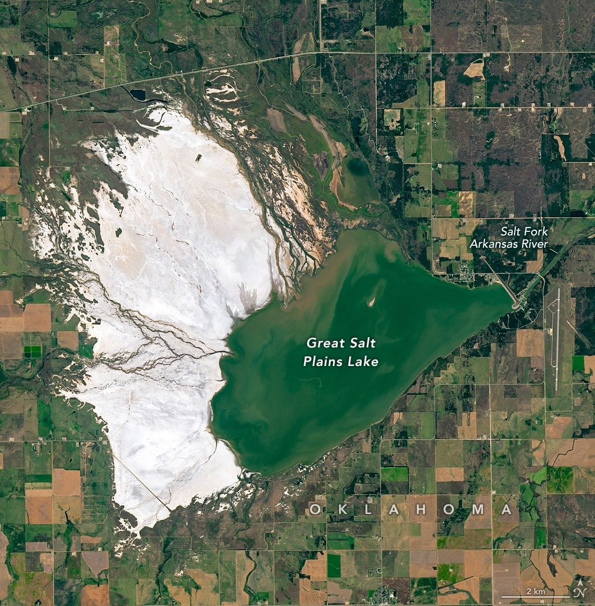
Landsat 8’s Operational Land Imager captured natural- and false-color images of the basin on October 10, 2025. The false-color combination (OLI bands 7-4-2) blends shortwave infrared with visible light so healthy vegetation appears dark red to purple and water shows up as blue; variation on the salt plain may reflect differing moisture or salinity levels, and shortwave infrared data can help estimate soil salinity.
The basin is partly filled by Great Salt Plains Lake, a shallow reservoir formed by damming the Salt Fork Arkansas River and fed by ephemeral streams.
selenite, salt plains, wildlife refuge, landsat 8, oli, false-color, shortwave infrared, soil salinity, salt fork, oklahoma