
Study maps 'ghost' roads to flag tropical forests at risk
A study published Dec. 22, 2025 in the journal Proceedings of the National Academy of Sciences analyzed roads across tropical forests in Brazil, the Congo and Southeast Asia and identified areas most at risk from illegal, unmapped "ghost" roads. Researchers examined 137 million hectares (about 338 million acres) of existing roads and found features—soil quality, proximity to rivers, topography and nearby population density—that make new road building more likely.
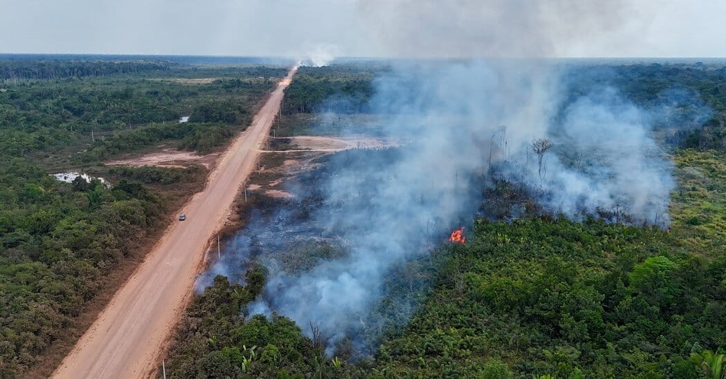
The study’s authors said most roads into sensitive land are built illegally; Jayden Engert of the Max Planck Institute of Animal Behavior said such ghost roads, not visible on maps, foreshadow tropical deforestation. The analysis flagged large areas of New Guinea, the Guiana Shield, the southern half of the Brazilian Amazon and the edges of the Congo Basin as high risk.
The team used recent satellite advances and earlier maps of hidden roads to show that unmapped roads can be up to seven times as common as official ones and that deforestation tends to follow an initial road with a burst of clearing and many secondary roads. An April study led by William Laurance and Dr.
Engert found that one kilometre of new road in the Amazon led to about 50 kilometres of secondary roads on average and enabled more than 300 times the deforestation of the first road; Laurance said, "Avoiding the first cut is key." Authors and other researchers described the work as a step toward predicting future road construction but noted limits.
Key Topics
Science, Ghost Roads, Amazon, Congo Basin, New Guinea, Guiana Shield