
Surveying Popes Creek
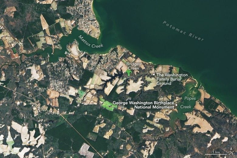
George Washington was born on February 22, 1732, in a brick house along Popes Creek in Westmoreland County, about 80 miles south of Mount Vernon. The Operational Land Imager on Landsat 8 captured the lands west of Popes Creek—now the George Washington Birthplace National Monument—on January 19, 2026.
The Washington family’s holdings extended northwest toward Mattox Creek. Their burial ground sits along Bridges Creek, where dozens of relatives are interred, including Washington’s parents, grandparents, and great-grandparents on his father’s side. Archaeological evidence shows Native Americans used the area to hunt and to harvest oysters, shad, and herring before European arrival.
Washington spent his first three-and-a-half years on the Popes Creek farm before his parents moved the family to Mount Vernon, and he made occasional visits afterward. As a teenager he drafted one of his earliest surveying maps of the lands around Popes Creek; the map accurately depicts Mattox Creek, Bridges Creek, and Popes Creek.
george washington, popes creek, westmoreland county, landsat 8, mount vernon, mattox creek, bridges creek, survey map, archaeology, native americans