
Wave of Dust Rolls Through Texas
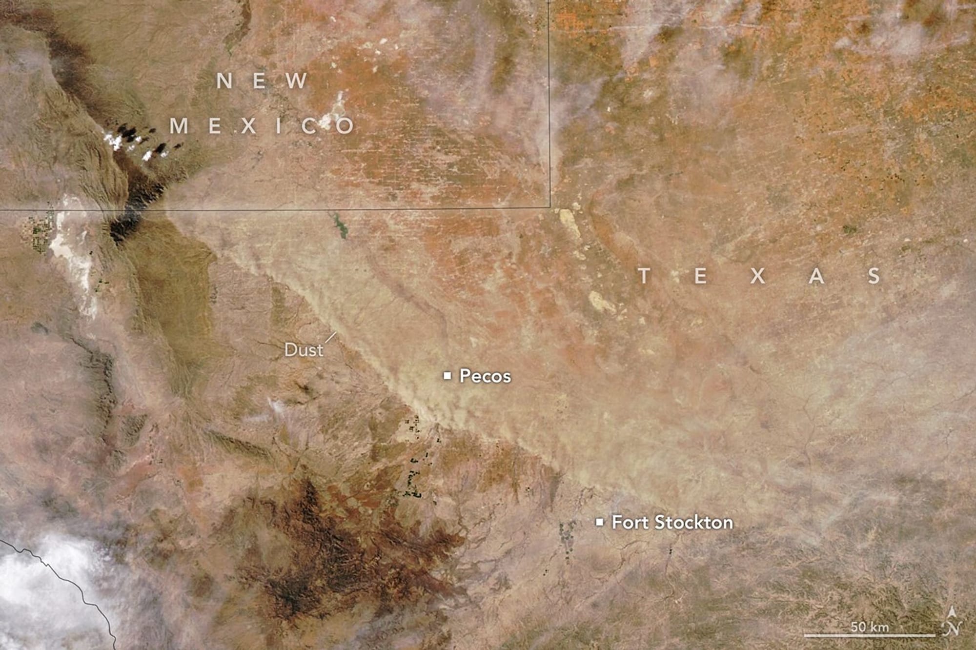
On March 15, 2026, an advancing cold front kicked up a sharp line of sand and other small particles that swept over the high plains of West Texas and the Panhandle. The MODIS instrument on the Aqua satellite captured the plume at about 4:45 p.m. Central Time (21:45 UTC) that day, and an image from the Terra satellite roughly five hours earlier showed the wall when it was about 150 miles (240 kilometers) to the northeast.
The cloud of suspended particles slashed visibility and made travel treacherous as it moved across the region. Storm-chaser footage shows visibility dropping to nearly zero, and similar conditions contributed to a multivehicle crash in North Texas. The National Weather Service issued a Red Flag Warning for March 15 because of high winds, low relative humidity, and dry fuels, and several wildland fires ignited in the Panhandle, prompting evacuations, according to news reports.
Weather shifted sharply with the front’s passage. A weather station in Pecos recorded a high of 88°F (31°C) at 4:30 p.m.
dust storm, west texas, texas panhandle, modis, aqua satellite, terra satellite, visibility, red flag, wildfires, multivehicle crash