
Winter storm leaves wide band of snow from U.S. Southwest to New England
A potent winter storm left a wide band of snow stretching from the U.S. Southwest to New England in late January 2026, the NASA Earth Observatory reported.
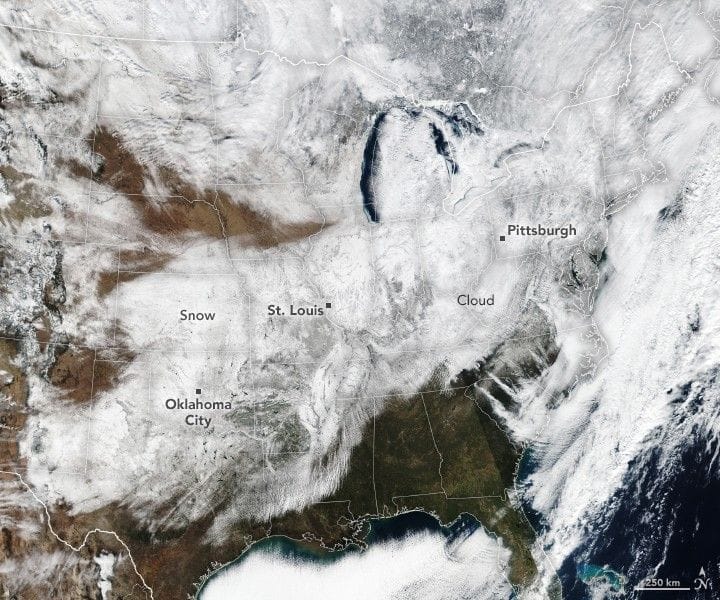
On the afternoon of January 26, the VIIRS instrument on the Suomi NPP satellite observed new snow covering a large swath of the country; a false-color combination of visible and infrared bands was used to distinguish snow from clouds. News reports said the heavy snow, along with bitterly cold temperatures, sleet, and ice, created treacherous travel conditions, toppled power lines, and prompted widespread school closures.
Preliminary National Weather Service data indicate snow accumulations of up to 12 inches (30 centimeters) in parts of Oklahoma between the mornings of January 23 and January 26, with higher totals across the Midwest and New England and around 20 inches reported in several Northeast states. Record daily accumulations included 5.1 inches in St. Louis on January 24 and 11.2 inches in Pittsburgh on January 25, and several inches of snow and sleet fell in parts of North Texas. With temperatures remaining below freezing in many places, the snow and ice may stick around, and NASA’s Disasters Response Coordination System has been activated to support federal partners and post maps and data products on its open-access mapping portal as new information becomes available.