
Extreme January cold grips large swath of U.S. after late-month winter storm
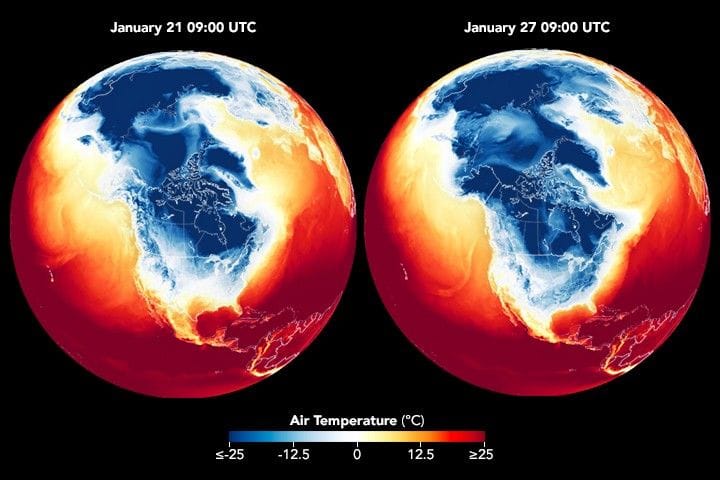
Following a winter storm that blanketed numerous states with snow and ice, frigid temperatures lingered in late January 2026 across a large swath of the United States east of the Rockies, NASA Earth Observatory reported on January 30, 2026. An animation from NASA Earth Observatory shows surface air temperatures across part of the Northern Hemisphere, including North America, from January 21 to 29.
The animation combines satellite observations with temperatures calculated by a version of the Goddard Earth Observing System (GEOS) global model; dark blue areas indicate the lowest surface air temperatures and brief pulses show daily warming and cooling while a broader pattern reveals cold air spreading south and east and lingering through much of the week.
According to the National Weather Service (NWS), a surge of Arctic air pushed deep into the United States on January 22, bringing low temperatures and harsh wind chills. That cold air coincided with a jet of moisture to produce significant accumulations of snow and ice spanning from the U.S.
Southwest to New England.
extreme january cold, nasa earth observatory, geos global model, national weather service, canadian arctic air, siberian arctic air, jet stream dip, winter storm snow and ice, alliance nebraska record low, south-central texas extreme cold, nasa disasters response coordination system