
Winds Fuel Fast-Moving Fires and Dust on the Southern Plains
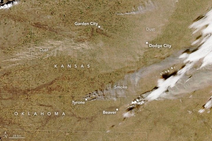
Dry, gusty conditions on February 17 drove fast-spreading wildland fires across the U.S. southern Plains, sending smoke and wind-blown dust streaming over the region. The MODIS instrument on the Aqua satellite captured the smoke and dust that afternoon. The largest blaze, the Ranger Road fire, ignited shortly after noon near Beaver, Oklahoma, and spread rapidly, crossing into Kansas by evening and consuming an estimated 145,000 acres (587,000 hectares).
Combined with the Stevens and Side Road fires near Tyrone, more than 155,000 acres burned that day. The Ranger Road fire showed characteristics of a fast fire — the kind that races through grasslands and shrublands when fuels are dry and winds are strong. Gusts reached up to 70 miles (110 kilometers) per hour across the Oklahoma and Texas panhandles on February 17, and persistent winds and dry conditions allowed several blazes to grow further on February 18, with the Ranger Road and Stevens fires roughly doubling in size.
Fierce winds also stirred dangerous dust.
United States, Beaver, Oklahoma
ranger road, stevens fire, side road, wildfires, smoke, dust, modis, aqua satellite, oklahoma panhandle, texas panhandle